Ed's Weather Station

Ed's Weather Station
Located south of Fulton, MO
Lat. 38.75234 N
Lon. 91.96758 W
Elevation 787 ft

GR3 Radar

Current 24 Hours Yesterday Last 48 Hours Last 72 Hours Last 30 Days Yearly Rainfall Yearly Temp Trends Monthly Wind Direction Last 30 Days Temperature Solar Data
Highs and Lows Trends Sun & Moon Rise\Set Times Moon\Solar Info
Local Weather Advisories Area Forecast Discussion NOAA-NWS Forecast Office Text Products Clickable NWS National Advisory Maps SPC Severe Weather Probabilities Storm Prediction Center
All Time Records Monthly Records Yearly Records
Weather Gauges MW Weather Network
Local Area Conditions US 24 Hour Temperature Change Charts Printable Weather Flyer MO River Information
About Ed's Weather Weather Station Status Weather Graphic Personal Weather Sites
Kansas City NEXRAD Radar St. Louis Radar Regional Radar GOES16 Satellite Loops
Weather Underground Data Rain Detail Chart
NWS Forecast Details Ed's Forecast Details NWS WPC Experimental US 3 Day Forecast Charts UV Forecast Pollen Forecast Snow or Ice Accumulation Potential US 3 Day Excessive Rainfall Forecasts Air Quality Forecast Space Weather
Member of the following organizations:

Weather Underground


Eds Weather Station - NOAA NWS Area Products

Select NOAA-NWS Forecast Office Text Products

(Product availability varies with seasons, forecast office, and weather.)

Hazardous Weather Outlook for St. Louis, MO

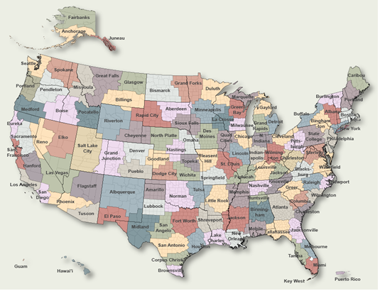
To Select Another NWS Office Click on Map or Choose from List

County Warning Area MAP
Select Forecast Office:   Select Product:  
000
FLUS43 KLSX 181923
HWOLSX

Hazardous Weather Outlook
National Weather Service St Louis MO
223 PM CDT Mon Mar 18 2024

ILZ058>060-064-065-069-070-074-079-095>102-MOZ018-019-026-027-
034>036-041-042-047>052-059>065-072>075-084-085-099-191930-
Greene IL-Macoupin IL-Montgomery IL-Bond IL-Fayette IL-Clinton IL-
Marion IL-Washington IL-Randolph IL-Adams IL-Brown IL-Pike IL-
Calhoun IL-Jersey IL-Madison IL-Saint Clair IL-Monroe IL-Knox MO-
Lewis MO-Shelby MO-Marion MO-Monroe MO-Ralls MO-Pike MO-Boone MO-
Audrain MO-Moniteau MO-Cole MO-Osage MO-Callaway MO-Montgomery MO-
Lincoln MO-Gasconade MO-Warren MO-Saint Charles MO-Franklin MO-
Saint Louis MO-Saint Louis City MO-Jefferson MO-Crawford MO-
Washington MO-Saint Francois MO-Sainte Genevieve MO-Iron MO-
Madison MO-Reynolds MO-
223 PM CDT Mon Mar 18 2024

This Hazardous Weather Outlook is for portions of eastern and
central Missouri as well as west central and southwest Illinois.

.DAY ONE...Tonight.

No hazardous weather is expected at this time.

.DAYS TWO THROUGH SEVEN...Tuesday through Sunday.

There is an Elevated Fire Danger across most of the area Tuesday
afternoon due to low relative humidity, breezy conditions, and dry
vegetation.

There is a slight chance of thunderstorms on Sunday.

.SPOTTER INFORMATION STATEMENT...

Spotter activation is not expected at this time.

$$

Pfahler

Previous Hazardous Weather Outlooks may be found at
NWS St. Louis, MO (LSX) Office Hazardous Weather Outlooks.
(Click 'Previous Version' there to view past versions successively.
Some may differ only in time posted.)

San Juan, PRHonolulu, HI Lake Charles, LA Pueblo, CO Corpus Christi, TX St. Louis, MO Reno, NV Raleigh, NC  Newport/Morehead City, NC Dodge City, KS Houston/Galveston, TX San Joaquin Valley/Hanford, CA Louisville, KY Fort Worth, TX Pittsburgh, PA Austin/San Antonio, TX Sacramento, CA Jackson, MS Phoenix, AZ Northern Indiana, IN Flagstaff, AZ Tallahassee, FL Springfield, MO Riverton, WY Blacksburg, VA Sioux Falls, SD El Paso Area, NM Columbia, SC Wilmington, NC Greenville-Spartanburg, SC Eureka, CA Midland/Odessa, TX Tucson, AZ Goodland, KS Huntsville, AL Amarillo, TX Norman, OK Lubbock, TX Marquette, MI Little Rock, AR Pendleton, OR Missoula, MT Binghamton, NY Boston, MA Green Bay, WI Billings, MT Baltimore/Washington San Diego, CA Tampa Bay, FL Morristown, TN Twin Cities, MN Brownsville, TX Portland, OR Des Moines, IA Memphis, TN Pocatello, ID San Angelo, TX Jacksonville, FL Aberdeen, SD Quad Cities, IA/IL Charleston, SC New Orleans/Baton Rouge, LA Peachtree City, GA Shreveport, LA Grand Rapids, MI Medford, OR Albany, NY Wichita, KS Gray/Portland, ME Spokane, WA Boise, ID Denver/Boulder, CO Great Falls, MT Caribou, ME Key West, FL Miami-South Florida, FL New York City/Upton, NY Melbourne, FL Hastings, NE Paducah, KY Glasgow, MT Bismarck, ND Charleston WV Omaha/Valley, NE Buffalo, NY Jackson, KY Kansas City/Pleasant Hill, MO Gaylord, MI Cheyenne, WY Grand Forks, ND Detroit/Pontiac, MI Central Illinois, IL Burlington, VT Salt Lake City, UT Topeka, KS Nashville, TN Milwaukee/Sullivan, WI Albuquerque, NM Las Vegas, NV Wakefield, VA La Crosse, WI Birmingham, AL Los Angeles/Oxnard, CA Chicago, IL Seattle, WA Rapid City, SD Indianapolis, IN Philadelphia/Mount Holly, PA Mobile/Pensacola State College, PA Cleveland, OH Elko, NV Wilmington, OH Grand Junction, CO North Platte, NE Tulsa, OK San Francisco/Monterey Bay Area, CA Duluth, MN Anchorage, AK Fairbanks, AK Juneau, AK Tiyan, GU

Products Courtesy of NOAA-NWS
NWS Information Parsing Script by Ken True at Saratoga Weather - WFO and Products Scripts by SE Lincoln Weather.
Mapping by Curly at Michiana Weather and by Tom at My Mishawaka Weather.